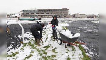
Storms drop tennis ball-sized hail over Plains during first evening of a multiday severe weather event
Severe thunderstorms are moving through the Plains, starting a multiday event of large hail, wind damage and a few tornadoes each day through Friday.
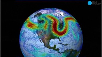
The severe weather threat is being fueled by an upper-level jet stream disturbance punching into the central US, where an area of low pressure has developed at the surface.
“One of the aspects of this that we’re watching very closely is called the dryline. This is very specific to the spring severe weather setup across parts of Texas and Oklahoma,” FOX Weather meteorologist Britta Merwin explained. “We have a big division here between the dry, dusty air in the Southwest … All of that dry, dusty air is pumping in and bumping up against this Gulf moisture that’s streaming up from the Gulf of Mexico. It nudges underneath that moisture and surges it way up into the atmosphere, and that allows for enough support to produce these independent thunderstorms ahead of a cold front.”
Tracking the severe weather threat
A Tornado Watch has been issued by the Storm Prediction Center for northeast Kansas, southeast Nebraska, northwestern Missouri and a large section of Iowa through at least 11 p.m. CDT. The watch box includes the city of Omaha, Nebraska.
The FOX Forecast Center said due to the position of a warm front, thunderstorms along the Interstate 29 corridor could have rotation and have a higher chance or producing a tornado.
A second Tornado Watch box has been issued for parts of Oklahoma and North Texas. The watch box includes the Oklahoma City metro area.
Additionally, a Severe Thunderstorm Watch has also been issued for northeast Iowa and southern Minnesota through 11 p.m. CDT.
In all watch boxes, hail to 3″ in diameter is possible and damaging wind gusts.
Severe storms threaten more than 22 million in central US on Wednesday
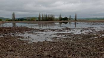
Hail has already been reported in several communities in Iowa, Illinois and Wisconsin from an early round of storms, but more rain is on the way.
The FOX Forecast Center expects large hail and damaging wind gusts to be the main threats, but an isolated tornado cannot be ruled out.
Ahead of the storms, a ground stop was issued for Chicago’s O’Hare International Airport due the proximity of hazardous weather.
The first Tornado Warning of the evening was issued for Mills County, Iowa, where doppler radar indicated rotation and the potential for a developing tornado.
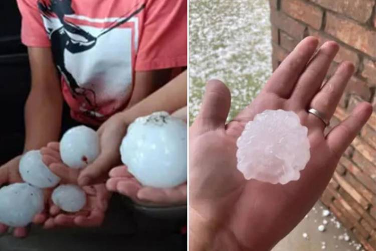
Radar also indicated very large rail impacting rural communities in southwest Iowa. Meteorologists estimated the hailstones could be the size of tennis balls or even grapefruits.
The storms also triggered meteorologists to issue a Tornado Warning south of the Oklahoma City metro, which included the communities of Newcastle and Moore.
The region has historically been home to some of the worst tornadoes in U.S. history, including an EF-5 that struck in 2013.
Storm chasers did report a lowering in the cloud layers but did not see a tornado on the ground.
In addition to the tornado threat, plenty of hail the size of baseballs and tennis balls fell around Oklahoma.
During the evening commute, drivers along several interstates found shelter under overpasses, which is not an advised safety precaution during a Tornado Warning, due to the potential for flying debris.
Clouds tops are estimated to have reached at least 50,000 feet, which enhances the threat of hailstones.
The National Weather Service in Norman, Oklahoma, also issued a Tornado Warning south of Oklahoma City, west of Interstate 35. The NWS said a tornado was observed and declared the event a particular dangerous situation.
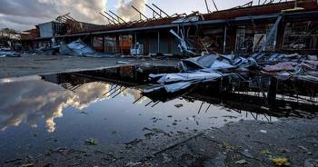
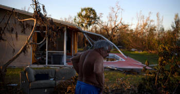
Storm Tracker Michael Beard spotted tree damage in Cole and several buildings that were impacted during the severe weather.
At least one agricultural facility appeared to be completely destroyed by the apparent tornado and PowerOutage.US reported at least 4,000 outages in the Sooner State.
Severe weather threat shifts south and east on Thursday
A dryline is expected to get overtaken by a cold front as it slides east from the southern Plains into the Ark-La-Tex region and the lower and mid-Mississippi Valley, the FOX Forecast Center said.
Severe storms, including supercells, are predicted to develop along and ahead of that cold front during the afternoon and evening hours across parts of Texas, southeastern Oklahoma, northwestern Louisiana, Arkansas and southeastern Missouri.
The main threats will be wind damage and large hail, but an isolated tornado or two is also possible.
A few strong to severe storms with risks of strong wind and hail could also spread into the western Great Lakes as far north as Chicago.
“Eventually, the cold front comes into play,” Merwin said. “That’s more of a line of thunderstorms that will kind of catch up to those independent thunderstorms along the dryline, and then we’ll be tracking those as we work our way … into Friday.”
Severe thunderstorms continue in South on Friday
The cold front will continue tracking eastward across portions of the southern Plains and lower Mississippi Valley on Friday.
Another round of severe thunderstorms is expected to develop near and ahead of the front, particularly from the middle and upper Texas coastal plain into western Louisiana. A few severe storms could also spread farther north and east into other portions of Louisiana, as well as Mississippi and southern and eastern Arkansas and southwestern Tennessee.
Large hail and damaging wind gusts will be the main threats once again. However, an isolated tornado or two can’t be ruled out.
Isolated severe storms could linger in Southeast on Saturday
On Saturday, the cold front will advance into the Southeast and mid-Atlantic states, where isolated severe storms with a wind-damage potential can’t be ruled out during the day. However, the FOX Forecast Center said the exact areas at risk remain uncertain since it’s still a few days away.
How to prepare for severe weather threat
Make sure that you have multiple ways to reliably receive weather alerts. The FOX Weather app can send you alerts based on your location and also has great information about how to create a severe weather safety plan.